
Geoyeolsanseong County Park
Geochang-gun is an inland mountainous region in the northwestern part of Gyeongsangnam-do, bordering Gyeongsangbuk-do and Jeollabuk-do across Deogyusan National Park...
Address: San 45-1, Sangnim-ri, Geochang-eup, Geochang-gun, Gyeongsangnam-do
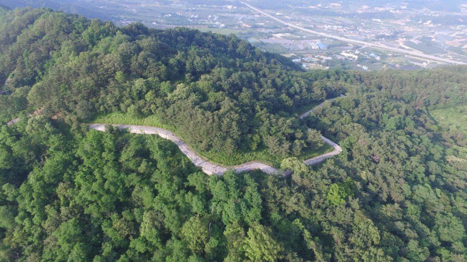
Geochang-gun is an inland mountainous region in the northwestern part of Gyeongsangnam-do, bordering Gyeongsangbuk-do and Jeollabuk-do across Deogyusan National Park. To the north rise Deogyusan, Wolbongsan, and Sudosan mountains; to the west, Gibaeksan and Geumwonsan mountains; and to the east, Uisangbong and Bigyasan mountains. The south is surrounded by relatively low Boroksan and Cheolmasan mountains, forming an intermountain basin. Geoyeolsanseong County Park is located about 3 km west of Geochang-eup and centers around Geoyeolseong Fortress, built by Baekje loyal martyrs and volunteer armies to rebuild the nation.
Geoyeolseong Fortress is a historic open-air educational site where a fierce battle took place: after resisting for three years following the fall of Baekje, it fell in the 3rd year of King Munmu of Silla (663) to Silla generals Kim Heum-sun and Cheonjon, resulting in the decapitation of some 700 Baekje revival soldiers. Existing ruins include a 2.1 km-long, 7 m-wide fortress wall that partially retains its original form, along with 7 watchtower sites and 2 wells. In addition, Geochang Sculpture Park is located along the bicycle-only road, allowing visitors to appreciate the beauty of great nature.
Visitor information
- 이용 시간: Open 24/7
- 쉬는 날: Open year-round
- 주차 안내: Available
- 문의 안내: Geochang-gun Office Tourism Promotion Division 055-940-3420